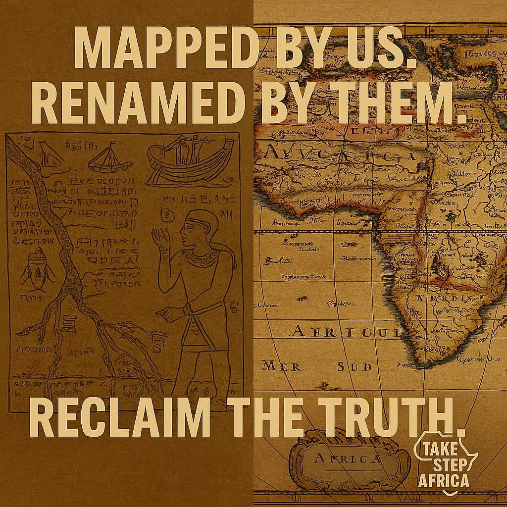
AFRICAN GEOGRAPHY | MAPPED BY AFRICANS, CLAIMED BY EMPIRES
🌍 AFRICAN GEOGRAPHY | MAPPED BY AFRICANS, CLAIMED BY EMPIRES 🇪🇬➡️🇪🇸🇫🇷🇬🇧🇸🇦.
Before colonial maps carved borders and renamed rivers, Africans had already charted their lands, stars, and trade routes. But Arab and European explorers didn’t just “discover” Africa. They appropriated African knowledge, then erased the source.
📜 What Was Taken?
🔹 Ancient Egypt & Nubia
Mapped the Nile’s seasonal cycles and tributaries. Used star charts to align temples and predict floods. Greeks and Romans later claimed this as “classical geography.”
🔹 West African Empires
Mali, Ghana, and Songhai used oral maps and trade routes across the Sahara
Arab geographers like Al-Idrisi documented African cities but often distorted them. Timbuktu’s scholars mapped rivers and trade hubs, yet Europe later claimed “first contact”
🔹 Swahili Coast & Great Lakes
Indigenous cartography guided trade from Kilwa to Zanzibar to Congo. Portuguese explorers used African pilots, then claimed the routes as their own
Mountains like Kilimanjaro were known locally Europe labeled them “discovered” in the 1800s
🧭 Colonial Cartography = Erasure
European maps labeled Africa as “unknown” while using African guides. Borders were drawn to divide tribes, not reflect geography. Sacred rivers, mountains, and cities were renamed or misrepresented
#TakeStepAfrica #ReclaimTheLand #PanAfricanTruth #CartographicJustice #TimbuktuWasFirst #KemetLegacy #AfricanGeography #StolenMaps